

Determining the exact volume of bulk materials, construction debris, or agricultural commodities is often time-consuming, inaccurate, and sometimes dangerous. At KS AERIAL WORKS, we use top-tier photogrammetry and drones with RTK modules for this task, delivering data with centimeter accuracy.
Let’s take a look at two recent case studies from our practice that show how our measurements work in real-world operations.
1. Construction and Demolition: Bulk Material and Debris Balance
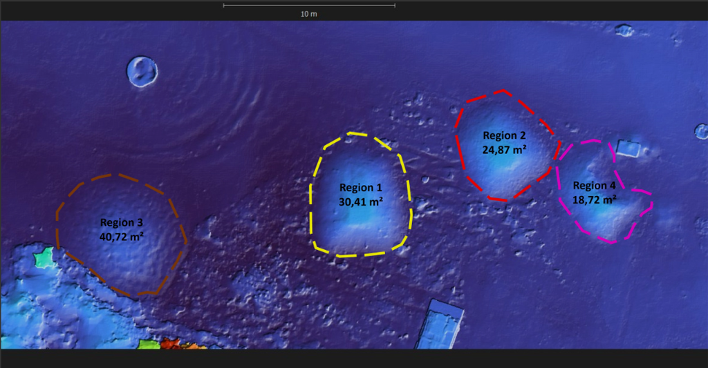
During earthworks and demolitions, knowing the exact amount of material destined for removal is crucial. During a recent project, we measured four stockpiles (construction rubble and unsorted sand).
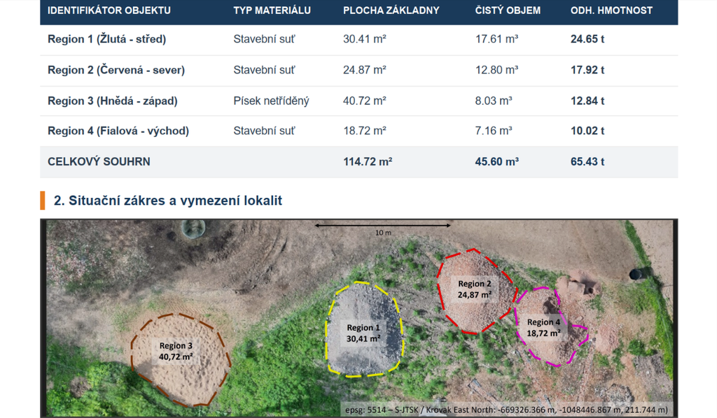
- Process: Using a DJI Matrice 4T drone with RTK FIX technology, we mapped the entire location in less than 30 minutes from a flight altitude of 55 meters.
- Results: A total area of 114.72 m² was surveyed, with a net material volume of 45.60 m³.
- Added Value: We provided the client with a precise report including an estimated weight conversion (approx. 65.43 tons) for easier freight planning. The guaranteed measurement deviation was a mere 3%.
2. Agriculture: Rapid inventory of bulky materials
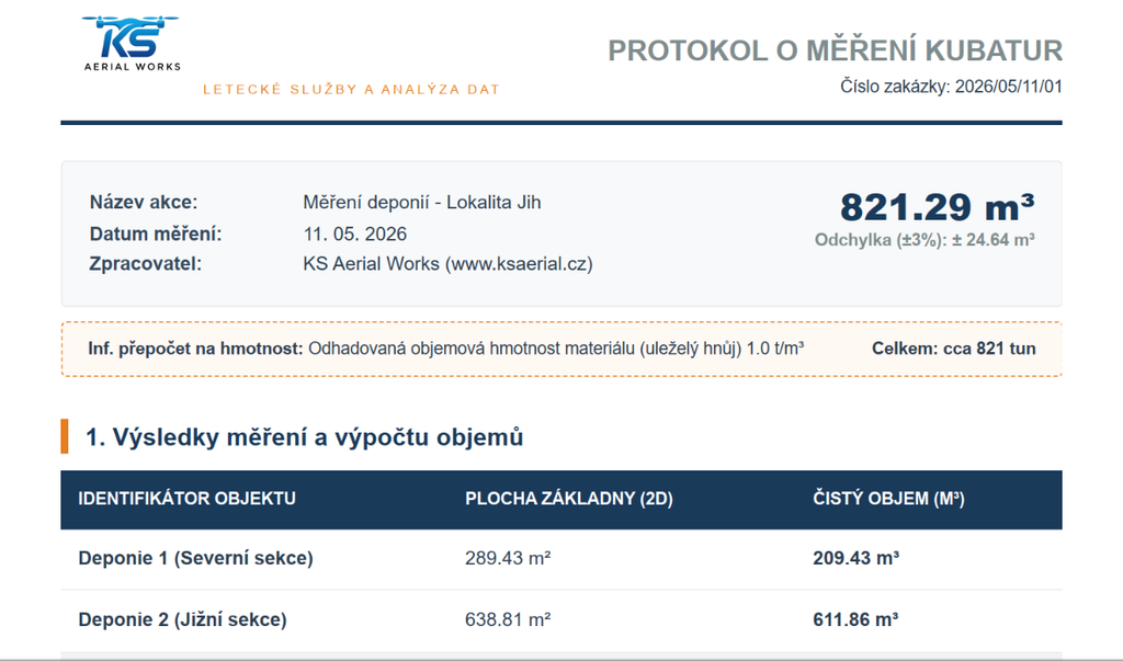
This method is equally effective for agricultural cooperatives or biogas plants. At the “South” location, we were called to survey two massive stockpiles of aged manure.
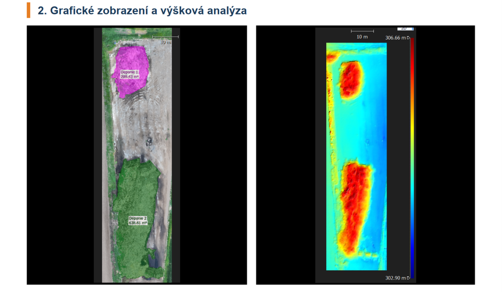
- Measurement Scope: We mapped a base with an impressive total area of 928.24 m².
- Processing: By analyzing the digital surface model (DSM) and an interpolated plane, we accurately calculated the material volume at 821.29 m³.
- Output for Records: The client received an official report with an estimated weight of 821 tons, all georeferenced in the Czech coordinate system (S-JTSK) and the Bpv height system.
Why entrust volume measurement to us?
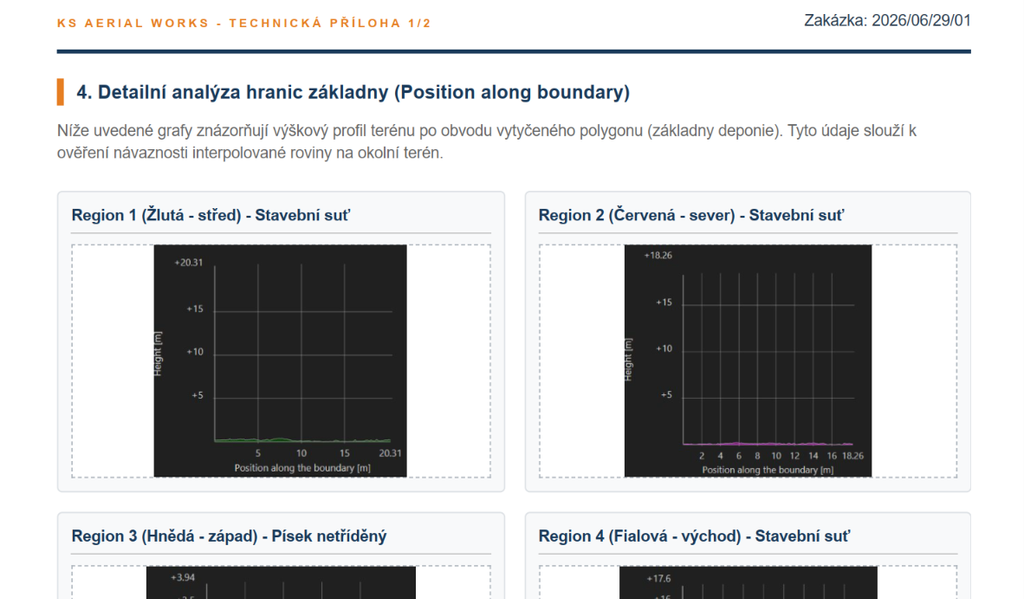
Drone measurement completely eliminates the need for personnel to move across unstable material piles. Our customers always receive a professional PDF report that serves as an indisputable basis for invoicing, inventory management, or logistics planning. The outputs also include detailed elevation profiles (heatmaps) and orthophoto maps for easy visual inspection of the site.
Do you need your stockpiles measured quickly and accurately?
Do not hesitate to contact us; we will be happy to prepare a non-binding quote tailored to your project.